DFW AirView is a comprehensive nationwide provider of drone services.
DFW AirView extends drone services across the entirety of the United States, spanning the contiguous 48 states and including regions within Hawaii and Alaska. Irrespective of your project’s locale—be it within a vibrant urban hub, a moderate-sized township, or a secluded rural expanse devoid of urbanization—our proficient team of pilots is primed to mobilize to any destination.
Initiate your imaging venture by reaching out to us at (682) 284-9925.

Dramatically improve efficiency across multiple industries
DFW AirView is a nationwide drone services enterprise specializing in acquiring aerial imaging data, empowering you to make informed and precise decisions. Our objective is to enhance accessibility and affordability of aerial data, enabling you to efficiently and safely address challenges.
Drone services for simple to sophisticated applications
LiDAR
Numerous licensed surveyors and engineering firms throughout the US are increasingly relying on DfwAirview to fulfill their LiDAR drone service requirements. Our proficient services and top-tier sensors are designed to efficiently reduce both time and costs for you.
Asset Inspection Services
Deploy drones to locations that pose hazards to human inspectors, such as steeply pitched roofs, industrial stacks, cell towers, wind turbines, hazardous waste sites, or emergency scenarios.
Progress Monitoring
Obtain aerial perspectives of your assets and projects with ease. Whether you require visual or thermal imaging, video or still images of challenging-to-access areas, we expertly capture and deliver them in readily usable formats.
Aerial Imaging
Access aerial vantage points for your assets and projects effortlessly. Whether you need visual or thermal imaging, as well as video or still images of difficult-to-reach areas, we adeptly capture and deliver them in immediately usable formats.
Marketing & Media
Create professional-grade videos, broadcast-quality, with or without drone footage. Enhance them with music, text, and animations to craft visually striking and memorable content that effectively conveys your core message.
With a wealth of experience spanning various industries and leveraging cutting-edge technology, DFW AirView is well-prepared to tackle projects of all scales. Whether your requirements are simple or intricate, our team is adept at delivering reliable drone service solutions tailored to help you achieve your objectives.


LiDAR Services
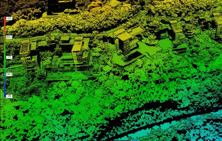
LiDAR (Light Detection and Ranging) represents a remote sensing technique renowned for its exceptional precision and accuracy in detecting objects within physical space. UAV LiDAR specifically entails a drone traversing a designated area while a sensor emits laser pulses onto surfaces at a frequency ranging from 100,000 to 3 million pulses per second. These pulses gauge the time taken for the signal to return.
Subsequently, LiDAR data is electronically amalgamated with GPS data and data from an inertial measurement unit (IMU) to generate a digital depiction of the scanned region in a point file format. This compiled data is then utilized by professional surveyors to construct high-quality deliverables.

